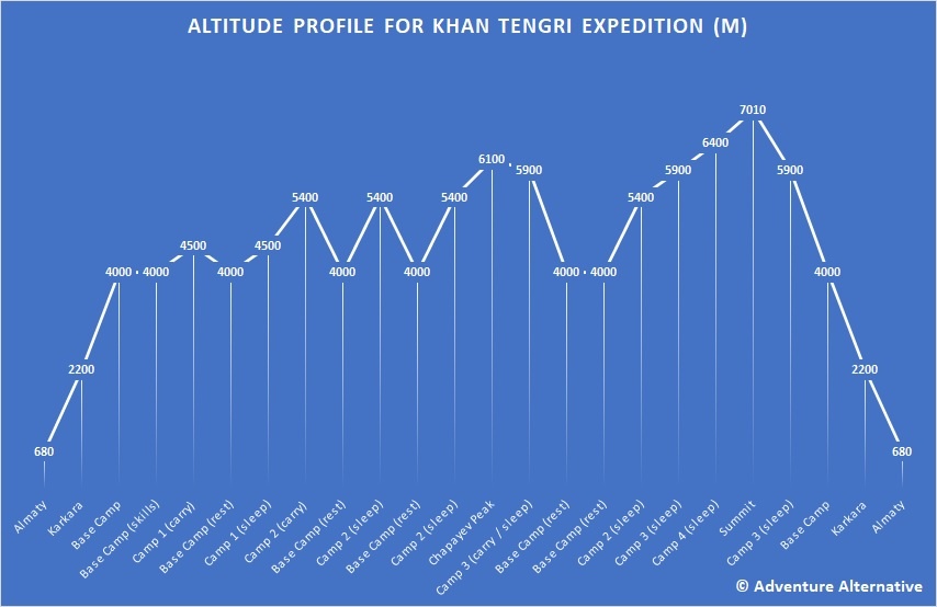
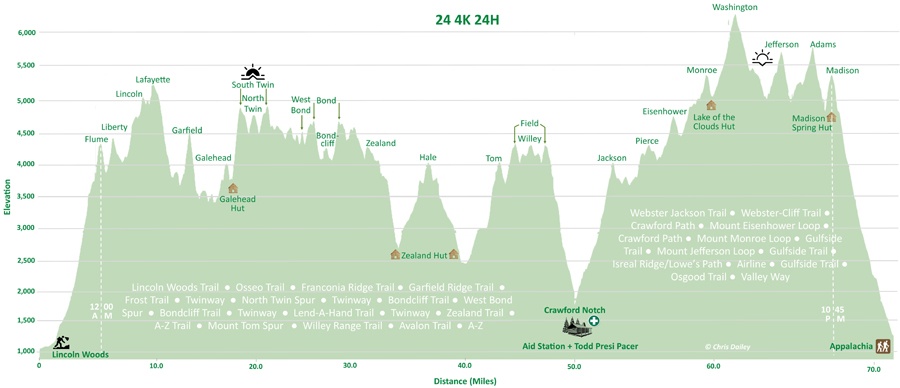
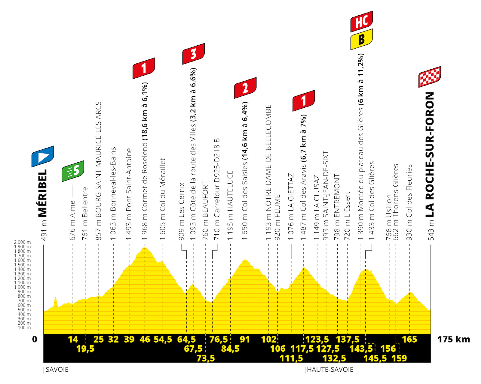
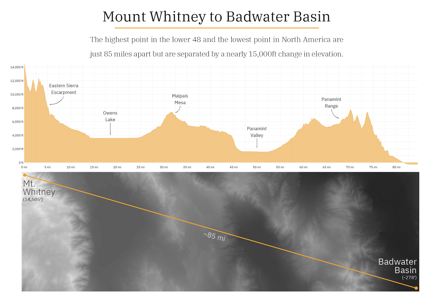
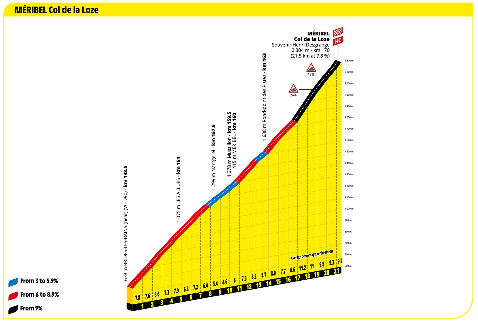
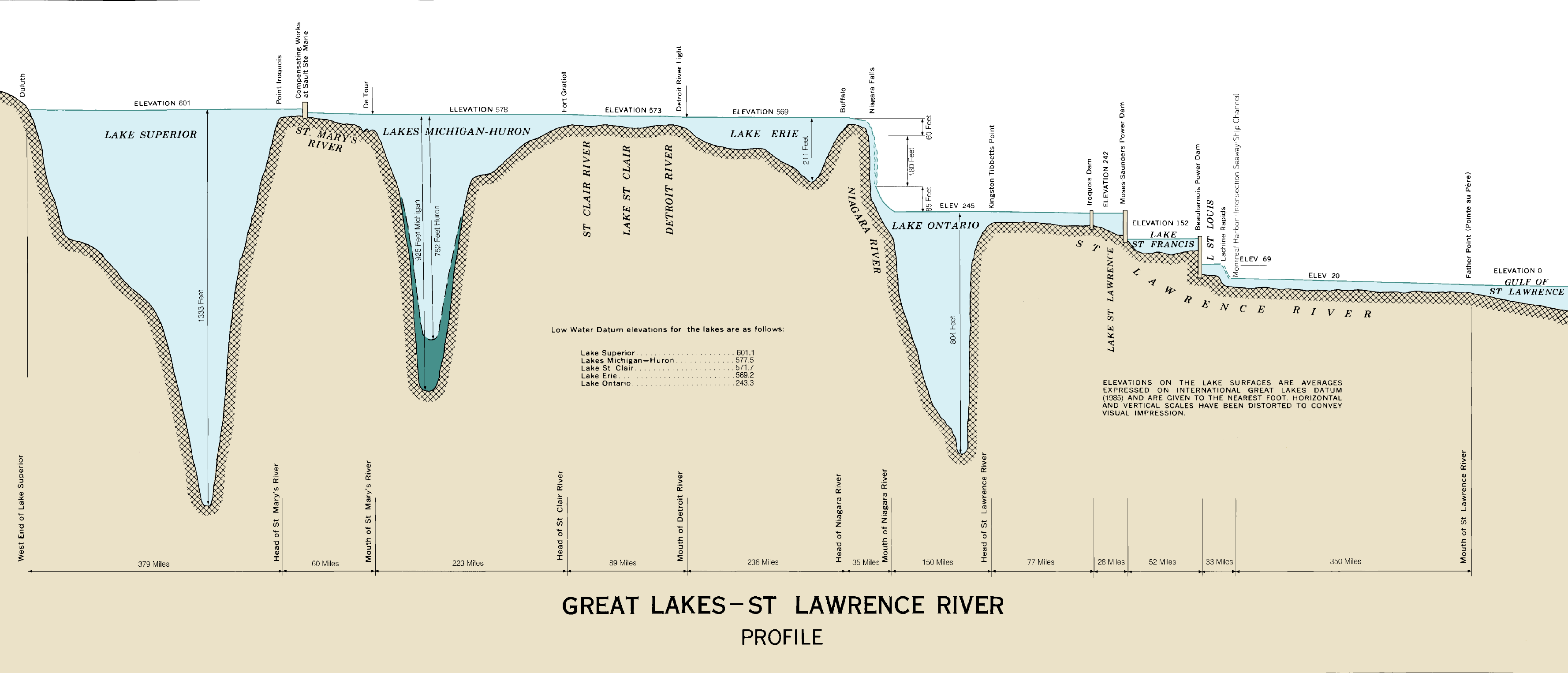
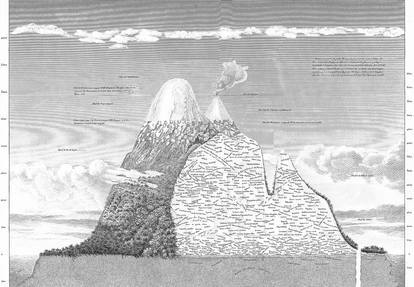
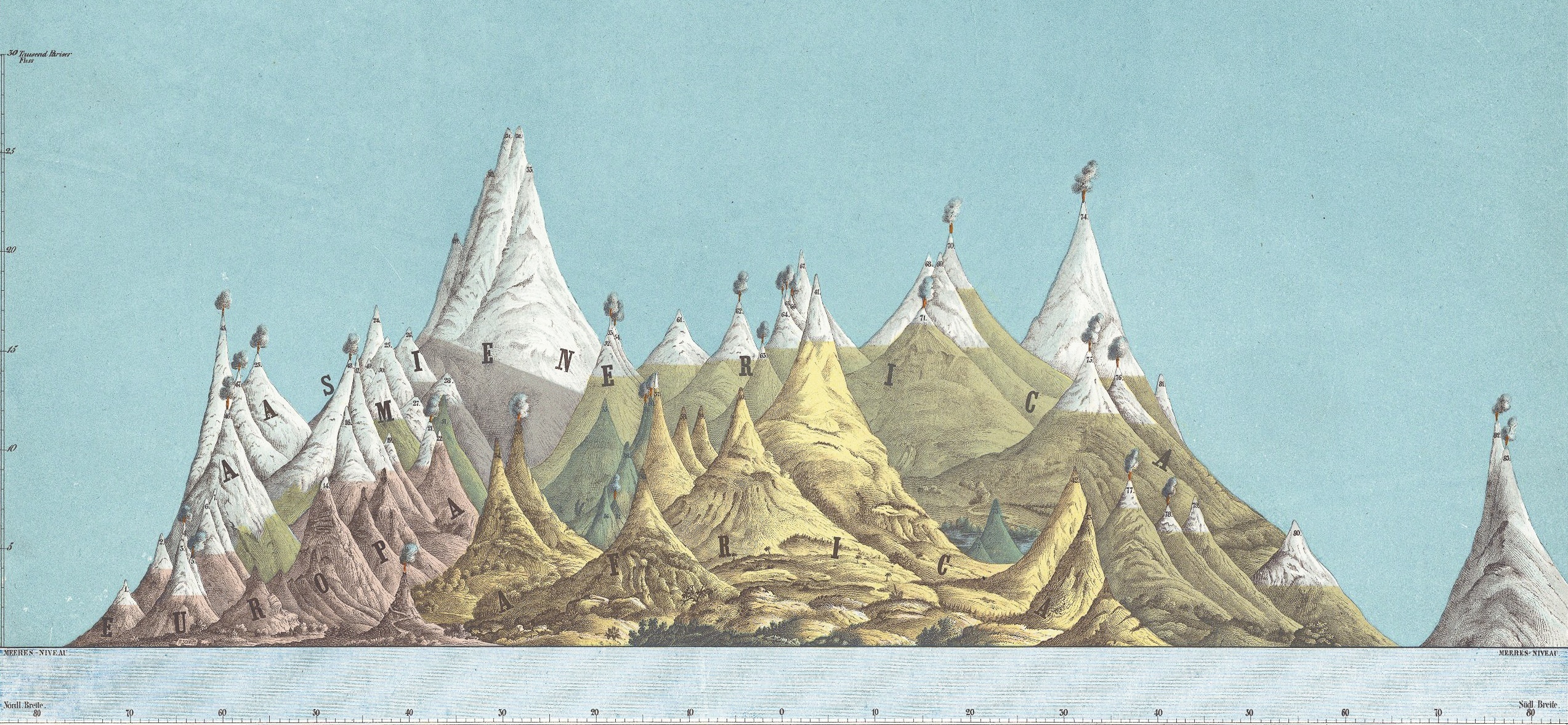
Profile Map
Also called: Topographic Profile or Elevation Profile
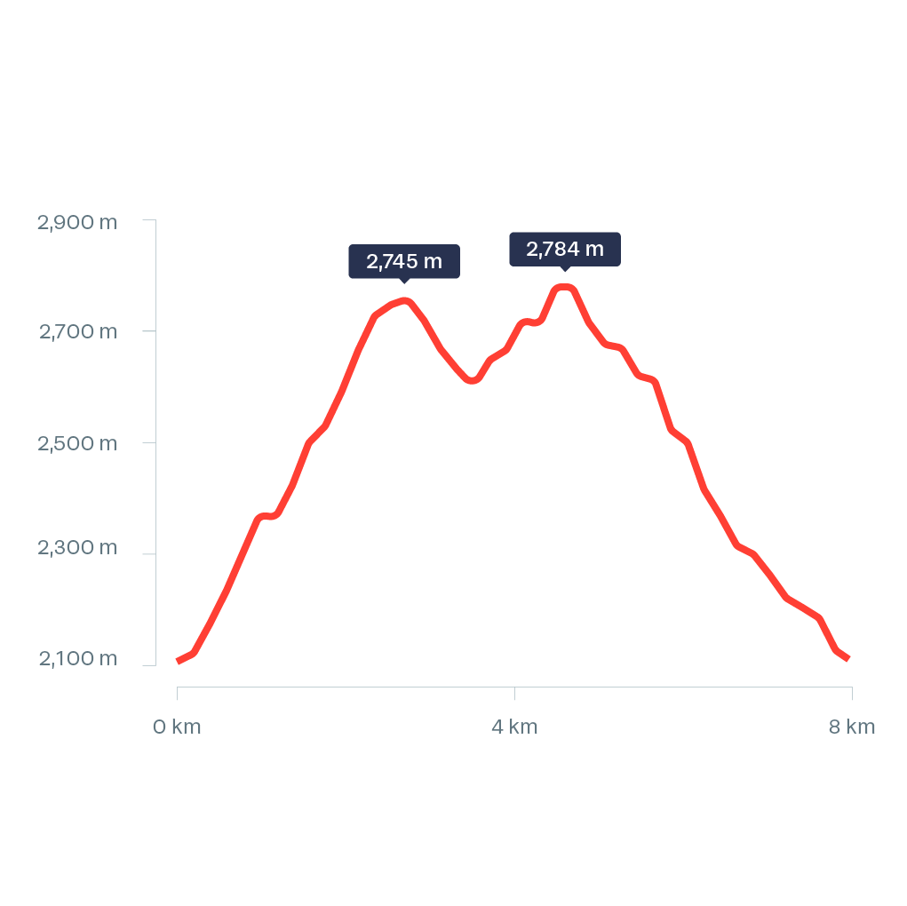
A profile map is a side view of geographical data, which focuses on elevation. It is a cross section of the terrain, showing the successive altitudes following a line or a path. The elevation values are plotted along the vertical axis, while the horizontal axis represents the distance along the path, whether it is a straight plane cutting through the space, or a more complex path followed along the terrain. In the latter case, a profile map can serve as a visualisation for a trail, showing the elevation gain along the hike.
To emphasise the elevation profile of the terrain, the vertical scale is usually exaggerated compared to the horizontal scale. A profile map can be constructed by tracing the cutting line on a topographic map and reporting the values where it crosses the elevation lines.