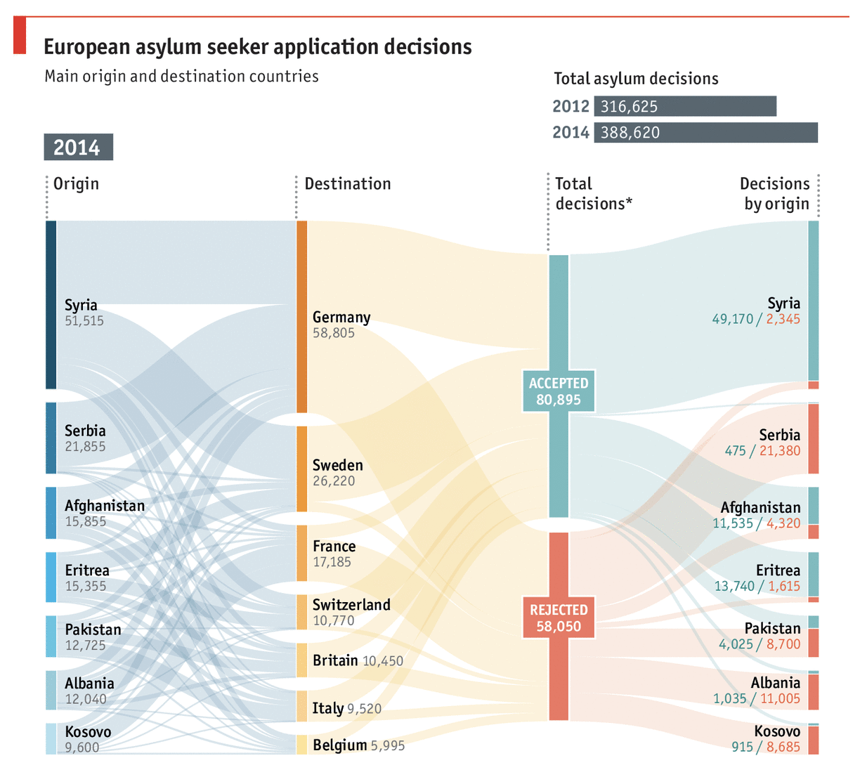
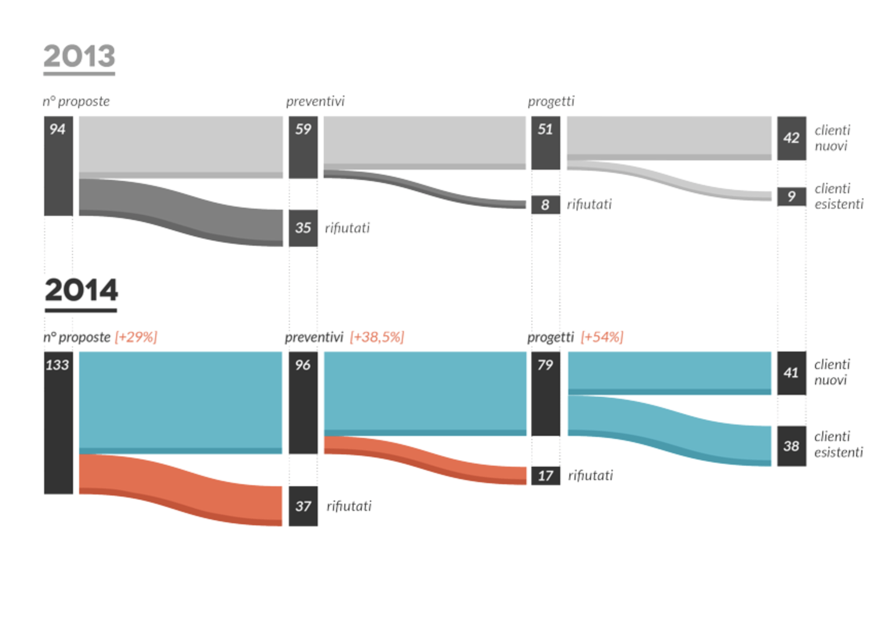
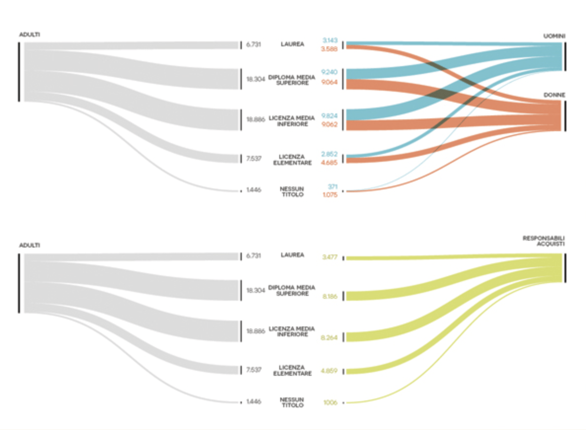
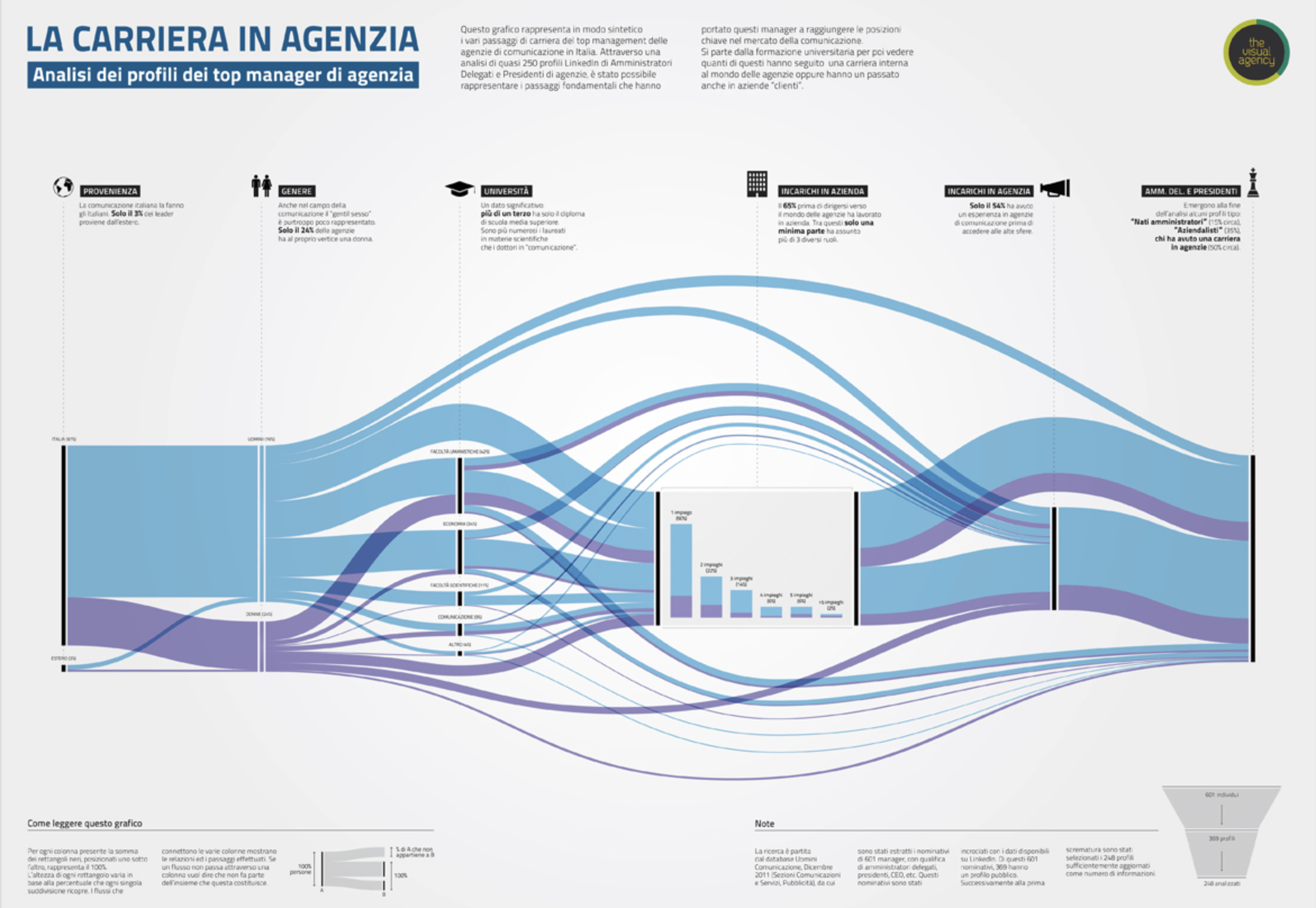
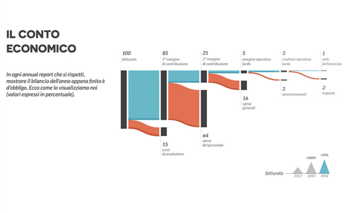
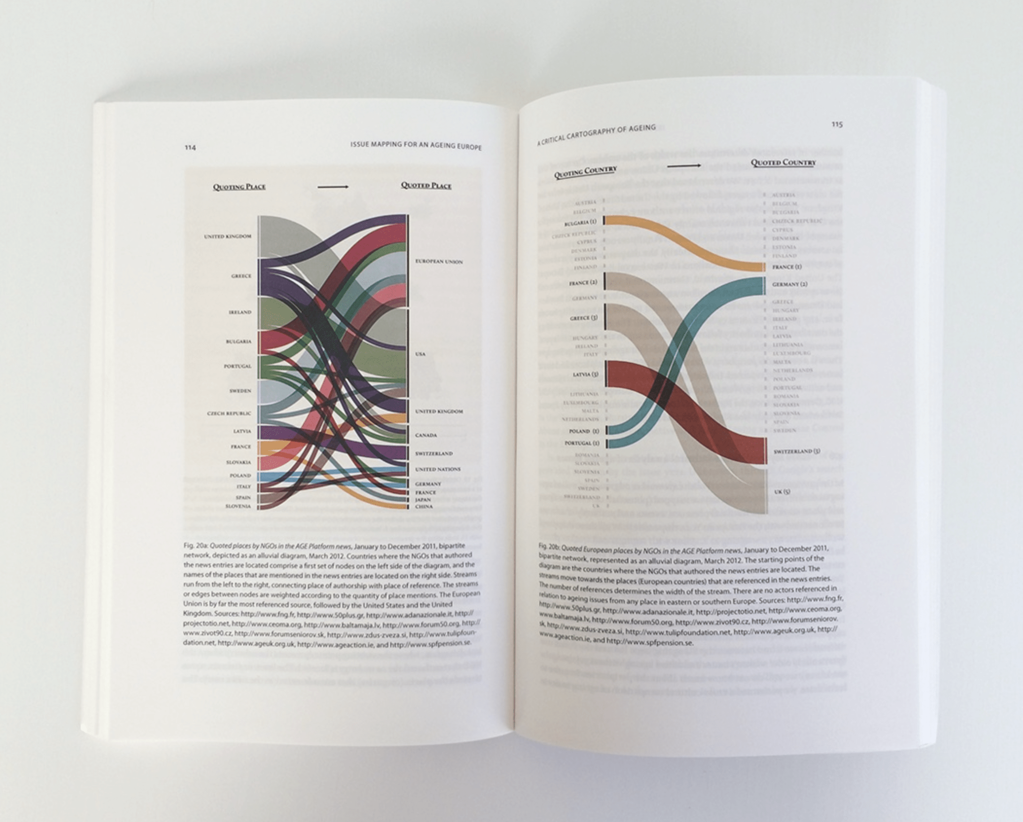
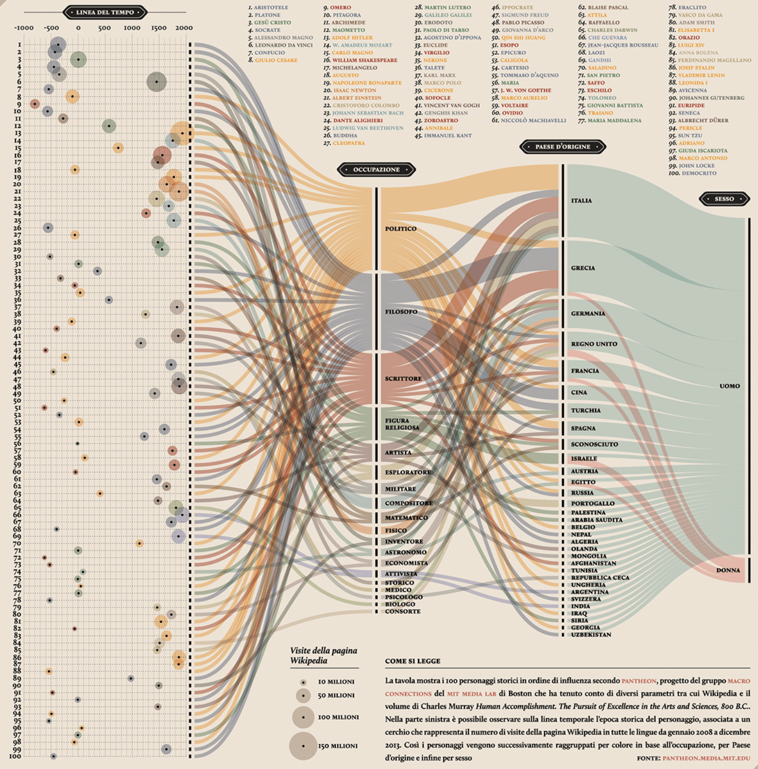
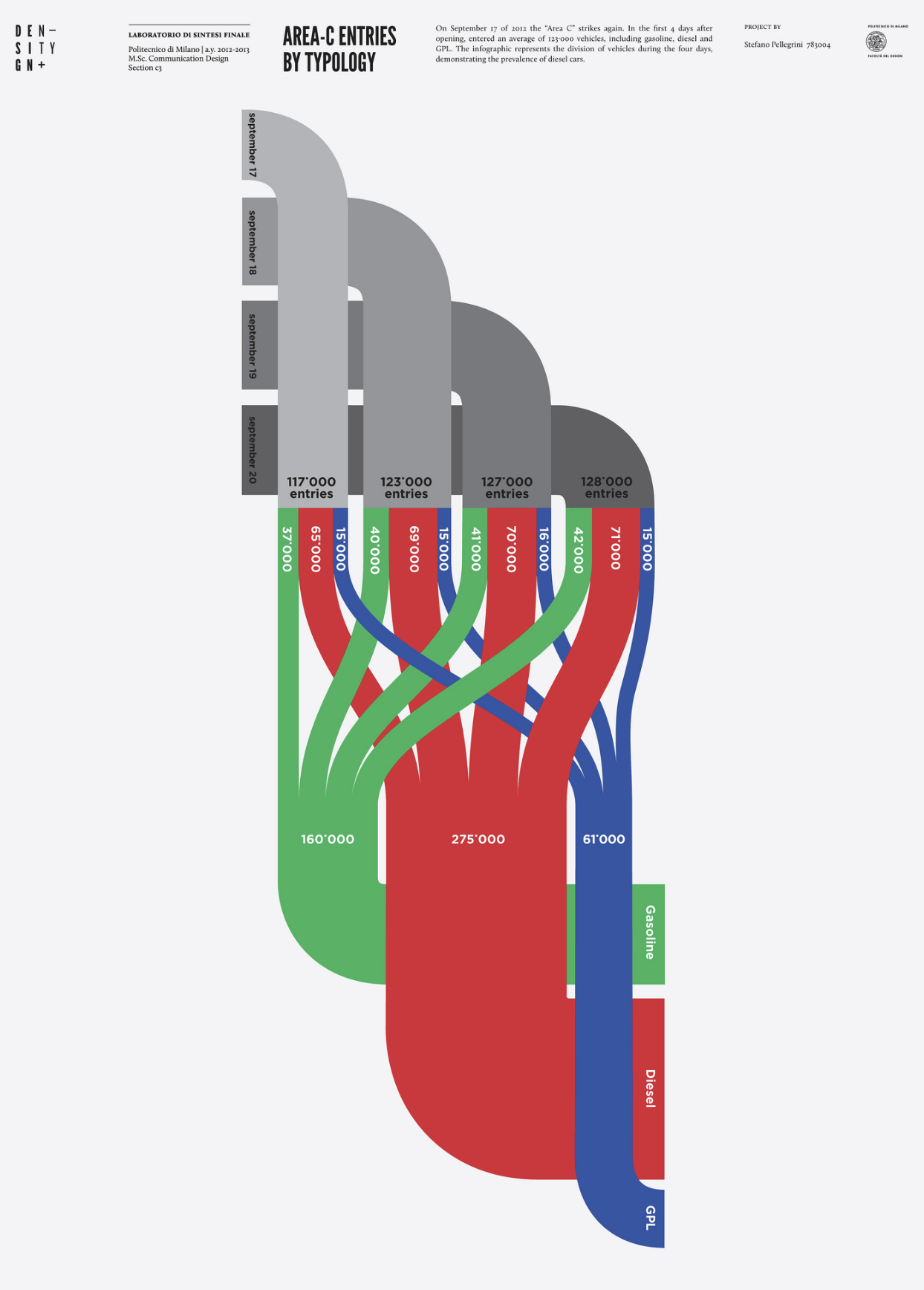
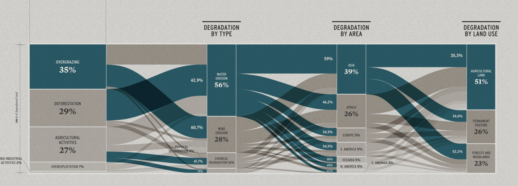
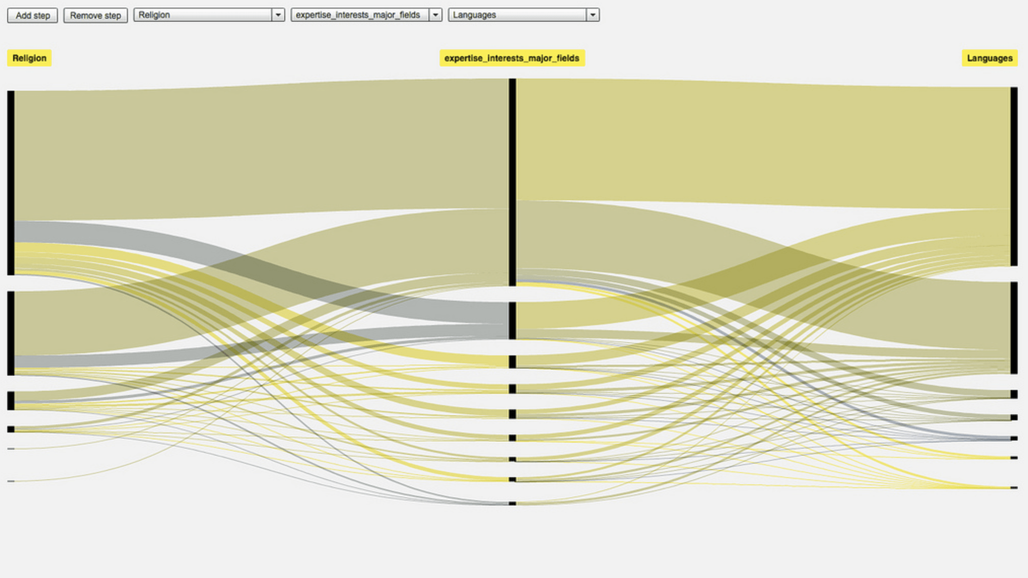
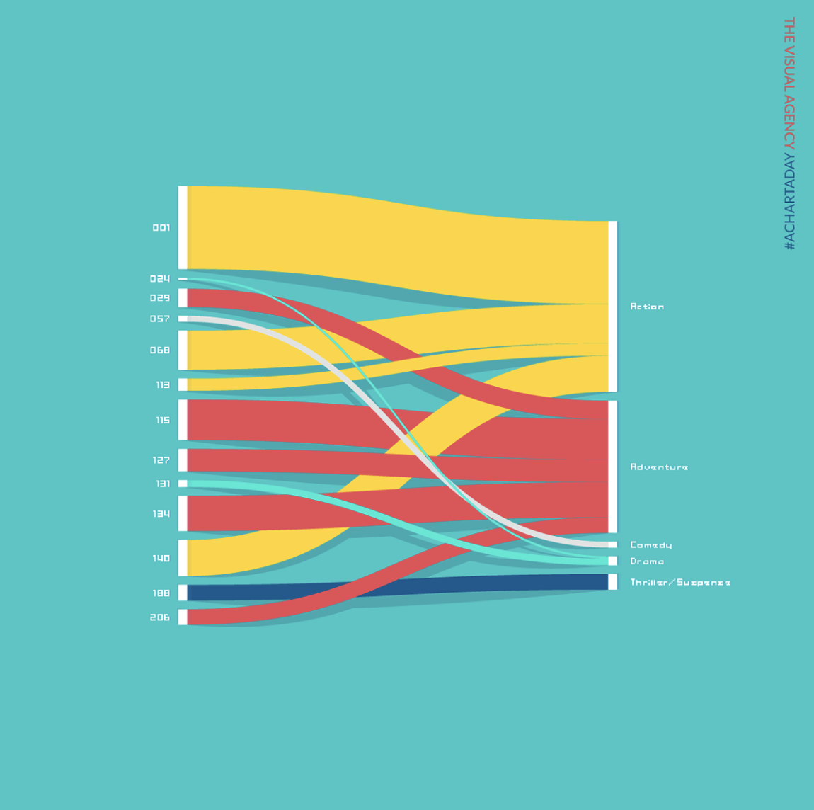
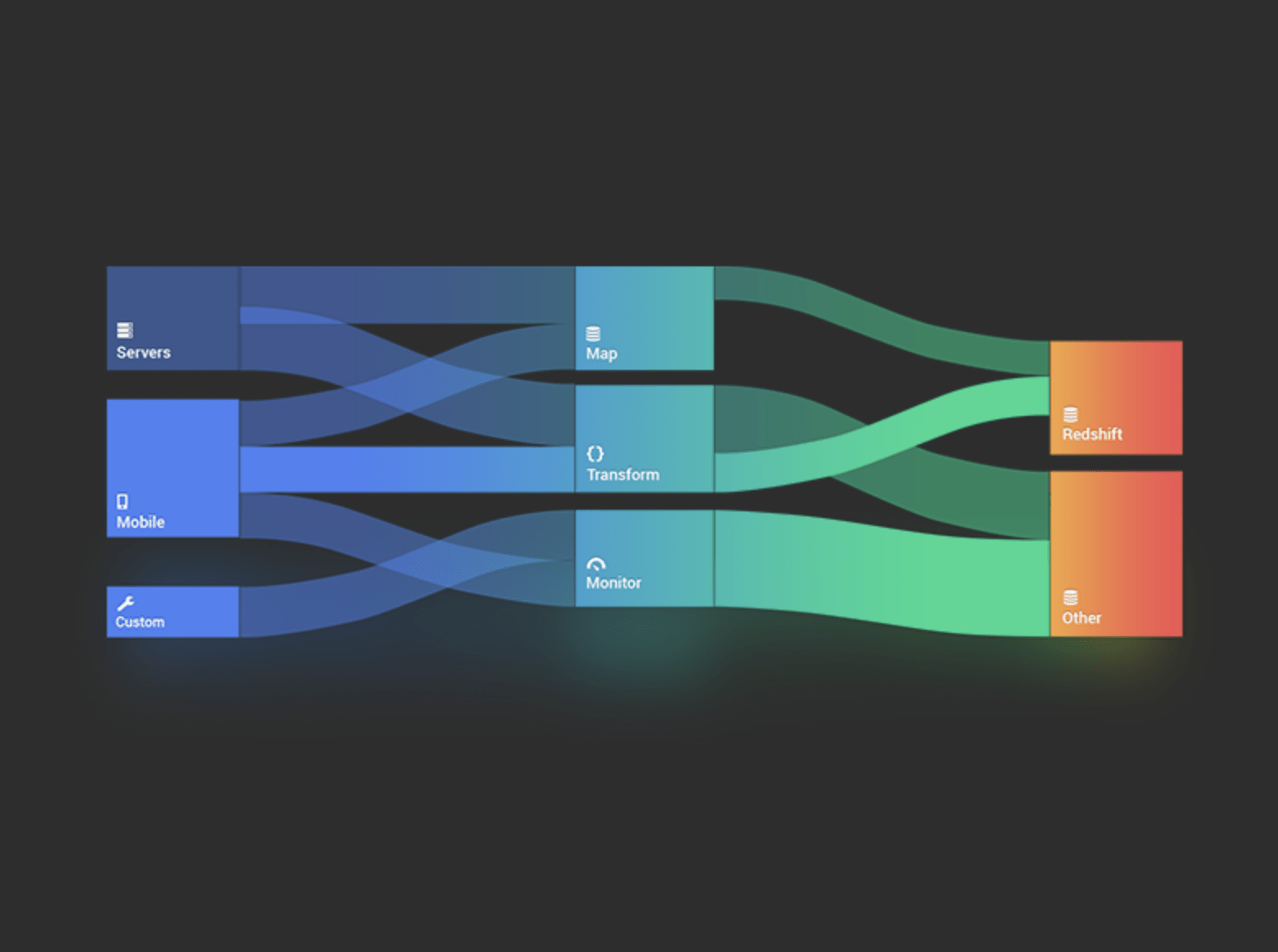
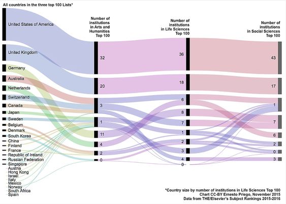
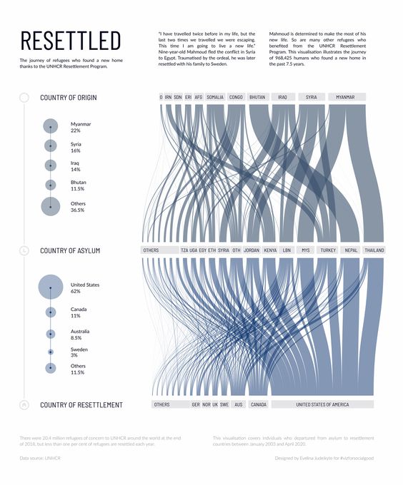
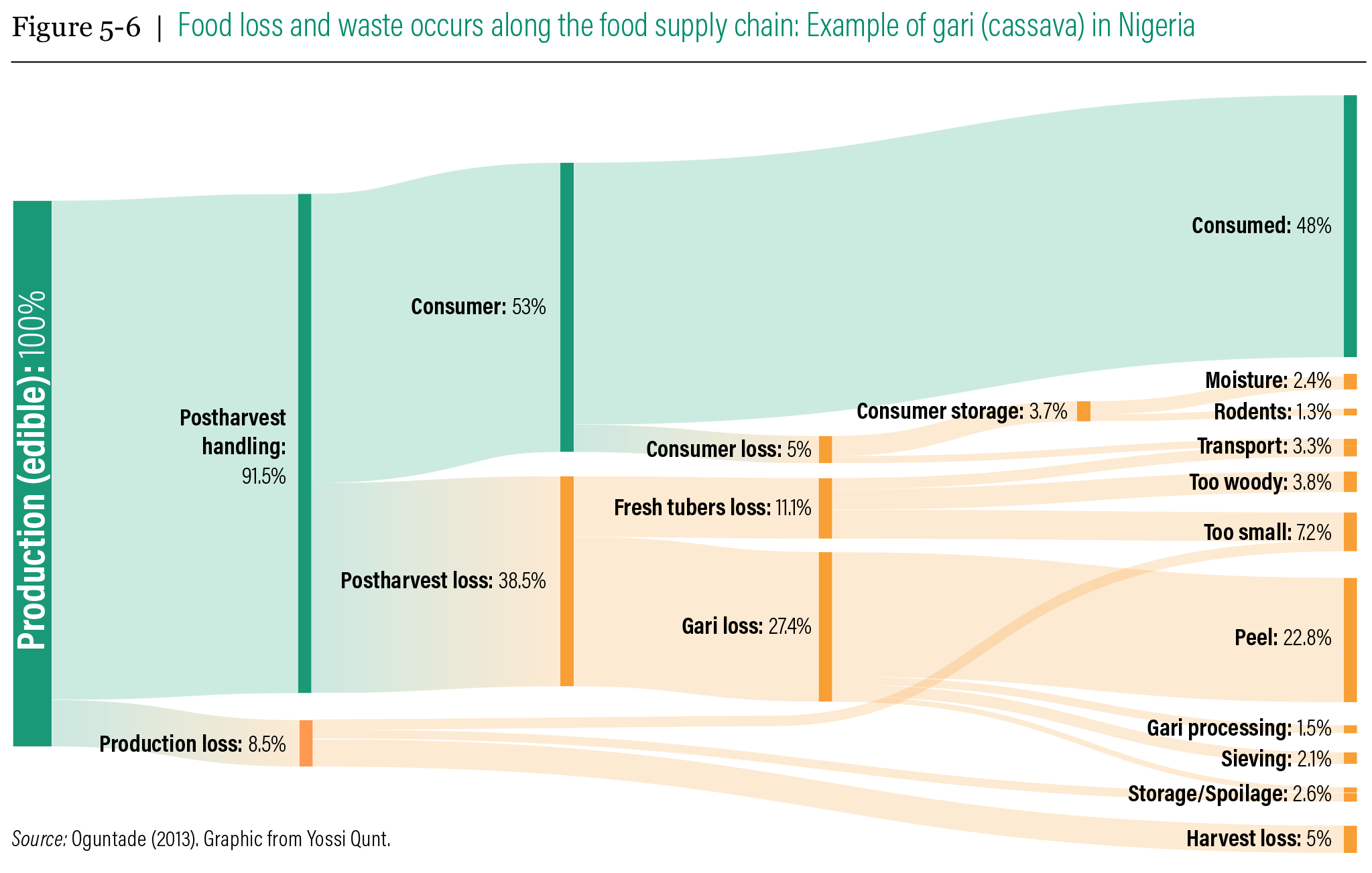
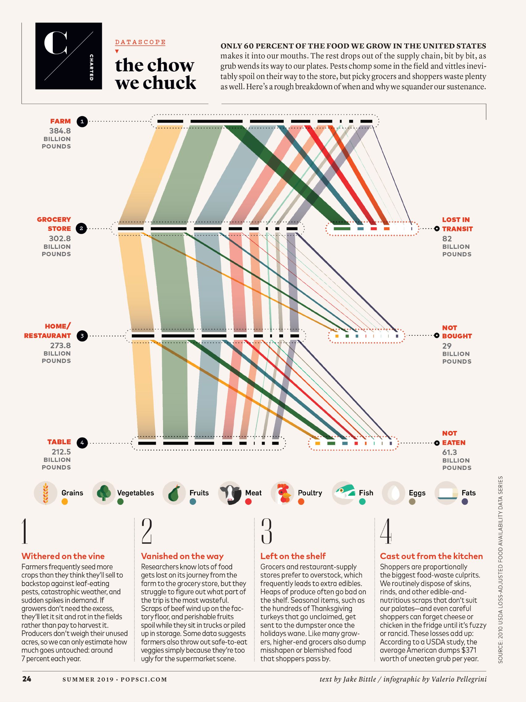
Alluvial Diagram
Alluvial diagrams are a type of flow diagram originally developed to represent changes in network structure over time. In allusion to both their visual appearance and their emphasis on flow, alluvial diagrams are named after alluvial fans that are naturally formed by the soil deposited from streaming water.
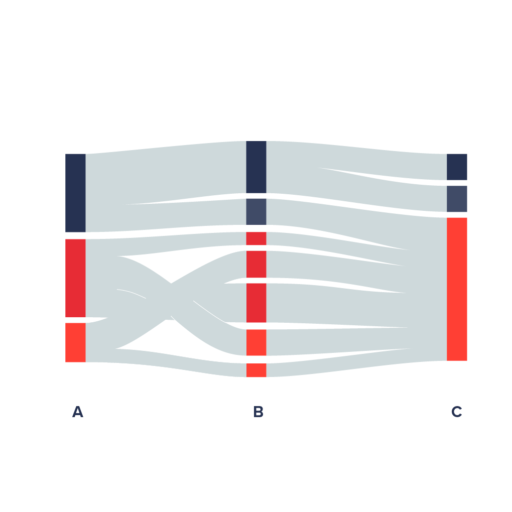
Variables are assigned to vertical axes that are parallel. Values are represented with blocks on each axis. The height of a block represents the size of the cluster and the height of a stream field represents the size of the components contained in both blocks connected by the stream field.
Alluvial diagram is a variant of the Parallel Sets but for categorical variables and often to display trends over time and phases.